Über uns
Bei BikeMaps lieben wir biken so sehr wie wir Karten lieben! Unser Ziel ist es Ihre Fahrerlebnisse zu dokumentieren und das Fahrrad fahren dadurch sicherer zu machen. Sie kennen lokalen Gefahrenstellen und wir wollen, dass Sie diese mit anderen Fahrradfahrern teilen. Ihr Wissen über Sicherheit und Gefahren, sowie Fahrraddiebstähle werden unter Verwendung von GIS und verschiedenen Statistiken analysiert, um so besonders gefährliche Gebiete zu identifizieren. Da wir im Begriff sind unsere Karten ständig zu aktualisieren, freut uns jede Rückmeldung. Machen Sie mit, um Radfahr-Karten auf Basis IHRER Erfahrungen zu generieren.
Kontakt
Haben Sie Fragen, Kommentare oder Feedback für uns? Wir würden das gerne hören! Email us at info@bikemaps.org.
FAQ
Warum sammelt ihr diese Daten?
Nur ca. 30% der Fahrradunfälle sind erfasst und es gibt keine zentrale Meldestelle. Wir haben zudem keinerlei Informationen über Beinaheunfälle
Was macht ihr mit den Daten ?
Das BikeMaps.org Team ist daran interessiert die eingegebenen Daten zu analysieren und Faktoren
zu finden, die die Fahrradfahr-Sicherheit beeinflussen. Wir wollen zudem ein Programm
entwickeln, das helfen kann, sicherere Routen zu planen und in lokale Routenplaner zu
integrieren.
Wie können Bürger und Gemeinden, Bereiche die von Interesse sind, überwachen?
In dem Sie sich registrieren und einloggen, können Sie eine Fahrt aufzeichnen oder eine bestimmte Region beobachten und Daten dazu verwalten. Benutzen Sie dazu die -Werkzeuge. Jedes Mal, wenn Sie sich einloggen, werden Sie über Ergebnisse in Ihrer Region durch die -Werkzeuge informiert.
I clicked submit, but noticed that my pin isn't in the right location. How can I fix it?
Email us at info@bikemaps.org with details about the time and location of your report and we will move it.
Do you have a video tutorial?
Yes! Here’s a link to a video that one of our followers made.
Why does the Strava heat map disappear when I zoom in?
Strava restricts street-level heat maps due to privacy and security concerns. If you are a registered Strava user, you can explore the global heatmap.
Wie kann ich mit machen?
Sie können die Seite über sozialen Netzwerken teilen, Gastgeber eines Demoabends werden oder auf freiwilliger Basis beim GIS bzw. der Entwicklung mit helfen. Wenn Sie einen Fahrradladen oder ein kleines Unternehmen besitzten, könent Sie gerne für uns Werbung machen. Wir sind auch auf der Suche nach Fördergeldern, um unsere Technologien weiter zu entwickeln und um die Studie auszudehnen. Zudem können weitere GIS Daten helfen BikeMaps.org zu verbessern.
Why can't I access my geolocation on my mobile device?
If you respond 'allow' to the BikeMaps.org request to use your location but still get a 'user denied geolocation' error, it might be that your privacy settings don't allow your browser itself to access your location. Check if your browser (Firefox, Chrome, Safari) has location permissions in your privacy settings.
Veröffentlichungen
Informieren Sie sich hier über unsere bereits veröffentlichten Arbeiten, um einen besseren Einblick zu bekommen.
- Laberee, K., Nelson, T., Branion-Calles, M., Ferster, C., & Winters, M. (2021). Crowdsourced bicycling crashes and near misses: trends in Canadian cities. Urban, Planning and Transport Research 9(1): 450-464. doi.org/10.1080/21650020.2021.1964376
- Ferster, C.J., Nelson, T., Laberee, K., & Winters, M. (2021). Mapping bicycling exposure and safety risk using Strava Metro. Applied Geography. doi.org/10.1016/j.apgeog.2021.102388
- Ferster, C., Laberee, K., Nelson, T., Thigpen, C., Simeone, M., & Winters, M. (2020). From advocacy to acceptance: Social media discussions of protected bike lane installations. Urban Studies. doi.org/10.1177%2F0042098020938252
- Fischer, J., Nelson, T., Laberee, K., & Winters, M. (2020). What does crowdsourced data tell us about bicycling injury? A case study in a mid-sized Canadian city. Accident Analysis & Prevention. doi.org/10.1016/j.aap.2020.105695
- Nelson, C., Ferster, C., Laberee, K., Fuller, D., & Winters, M. (2020). Crowdsourced data for bicycling research and practice. Transport Reviews. doi.org/10.1080/01441647.2020.1806943
- Ferster, C., Fischer, J., Manaugh, K., Nelson, T., and Winters, M. (2019). Using OpenStreetMap to inventory bicycle infrastructure: a comparison with open data from cities. International Journal of Sustainable Transportation (18-01501). doi.org/10.1016/j.aap.2017.11.008
- Boss, D., Nelson, T., Winters, M., and Ferster, C. (2018). Using crowdsourced data to monitor change in spatial patterns of bicycle ridership. Journal of Transport and Health. 9: 226-233. doi.org/10.1016/j.jth.2018.02.008
- Boss, D., Nelson, T., and Winters, M. (2018). Monitoring city wide patterns of cycling safety. Accident Analysis and Prevention. 111: 101-108. doi.org/10.1016/j.aap.2017.11.008
- Branion-Calles, M., Nelson, T., and Winters, M. (2017). Comparing crowdsourced near-miss and collision cycling data and official bike safety reporting. Transportation Research Record: Journal of the Transportation Research Board, No. 2662, pp. 1–11. doi.org/10.3141/2662-01
- Jestico B, Nelson TA, Potter J, Winters M. (2017). Multiuse trail intersection safety analysis: a crowdsourced perspective. Accident Analysis and Prevention 103: 65-71. doi.org/10.1016/j.aap.2017.03.024
- Ferster C, Nelson TA, Laberee K, Vanlaar W, Winters M. (2017). Promoting crowdsourcing for urban research: cycling safety citizen science in four cities. Urban Science 1(2): 21. doi:10.3390/urbansci1020021
- Ferster CJ, Nelson TA, Winters M, Laberee K. (2017). Geographic age and gender representation in volunteered cycling safety data: a case study of BikeMaps.org. Applied Geography 88: 144-150. doi.org/10.1016/j.apgeog.2017.09.007.
- Jestico B, Nelson TA, Winters M. (2016). Mapping ridership using crowdsourced cycling data. Journal of Transport Geography. 52: 90-97. doi.org/10.1016/j.jtrangeo.2016.03.006
- Nelson, TA, Denouden, T, Jestico, B, Laberee, K, and Winters, M. (2015). BikeMaps.org: a global tool for collision and near miss mapping. Frontiers in Public Health.doi:10.3389/fpubh.00053
Unterstützer


Team
Dr. Trisalyn Nelson
Founder of BikeMaps.org
Trisalyn is the founder of BikeMaps.org. She is a geography professor at University California Santa Barbara and the Jack and Laura Dangermond Chair of Geography. She is also adjunct faculty at the University of Victoria. As a mom, avid cyclist, and data scientist, Trisalyn's vision for BikeMaps.org is to make bicycling more accessible to more people by improving data for decision making.
Dr. Meghan Winters
Metro Vancouver Forschungsleiterin
Meghan Winters is a Professor in the Faculty of Health Sciences at Simon Fraser University, and a Michael Smith Foundation for Health Research Scholar. Her research focuses on ways that cities and their infrastructure can play a role in promoting healthy and safe transportation, for people of all ages and abilities. She is happiest when working in close collaboration with cities and stakeholders to conduct research and create tools that address real-world challenges.
Karen Laberee, MSc.
Executive Director
Karen has been part of the BikeMaps.org team since the project began in 2014. She has managed many aspects of the project and has been heavily involved in community outreach and engagement. Karen is also the project coordinator for WalkRollMap.org, CanBICS, and INTERACT Victoria. In her personal life, Karen has gained considerable experience volunteering on numerous boards that support amateur sports or community initiatives. Most weekends, Karen can be found running the beautiful trails around Victoria.
Dr. Colin Ferster
Post-Doctoral Research Associate
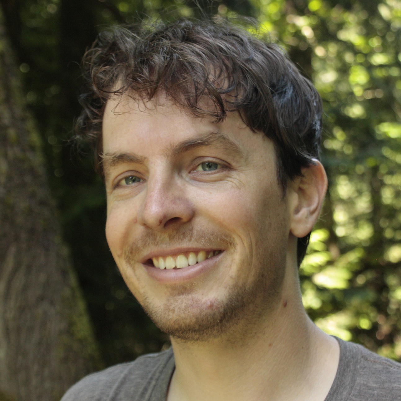
Colin uses traditional and emerging geographic data to better understand people and their environments. A long-time city and mountain biker, Colin is happy to be part of the BikeMaps.org team as a developer and researcher because it combines his favorite things: maps, apps, people, and bikes!
Moreno Zanotto, MSc.
Communication and Outreach, Metro Vancouver
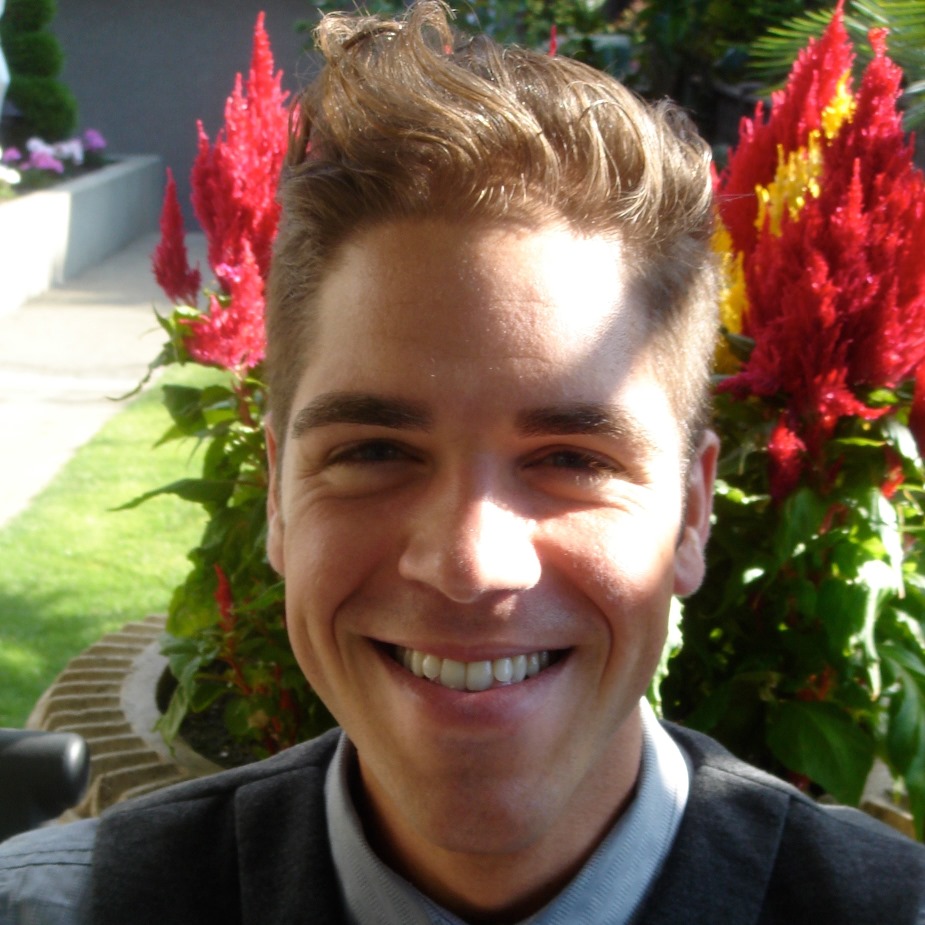
Moreno joined the BikeMaps team in Fall of 2015. He is based in Vancouver and helps coordinate BikeMaps.org promotion and community outreach efforts in the region. A graduate of SFU’s Faculty of Health Sciences, Moreno completed his thesis research on the impending Vancouver public bike share system. Moreno views cycling as a solution to many health, social, and environmental problems, and as the centrepiece of a more sustainable, egalitarian, and inclusive society.
Jaimy Fischer
Research Assistant
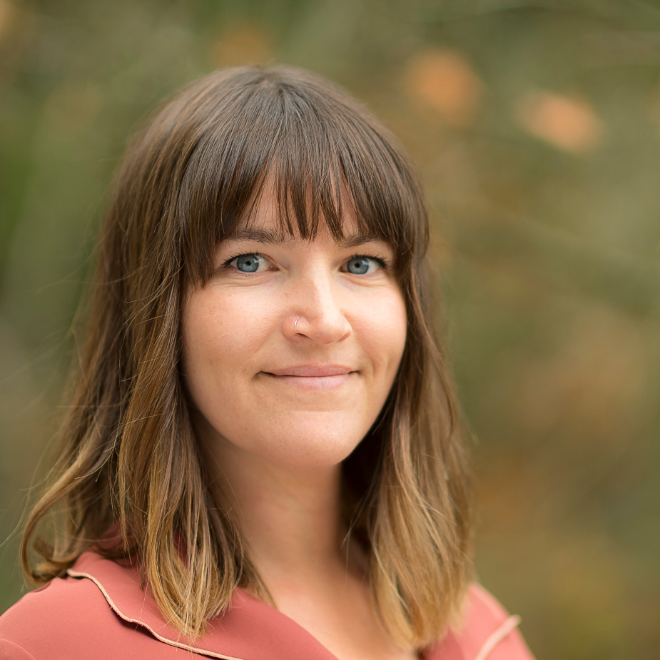
Jaimy joined the BikeMaps team in 2016. She is currently pursuing her PhD with Dr. Meghan Winters at Simon Fraser University. As part of her work, Jaimy will be looking at the link between investment in All Ages and Abilities (AAA) bicycle infrastructure and ridership and safety outcomes. Her work is part of the larger Impacts of Bicycle Infrastructure in Mid-Sized Cities project, and through it she’ll be advancing skills in predictive modelling and spatial analysis approaches to model bicycling exposure and safety.
Daniel Fuller
Atlantic Research Lead
Daniel Fuller is a Canada Research Chair in Population Physical Activity in the School of Human Kinetics and Recreation at Memorial University. His research is focused on using wearable technologies to study physical activity, transportation interventions, and equity in urban spaces. Dan has an MSc in Kinesiology from the University of Saskatchewan, a PhD in Public Health from Université de Montréal. Dan is the Principal Investigator on the INTERACT team and Neighbourhood Factors Team co-lead of the Canadian Urban Environmental Health (CANUE) Research Consortium. He spends free time chasing his two rambunctious kids.
Finn Short
Entwickler
Finn studied geography at VIU in Nanaimo and computer science at Concordia in Montreal, and is excited to be contributing to the Bikemaps team as a software developer. Outside the office they enjoy mountain biking, running, and rock climbing.
Darren Boss, MSc.
Entwickler
Darren completed his MSc in the SPAR lab at UVic in 2017. He continues his involvement with BikeMaps and is the lead developer for WalkRollMap.org. When not coding away, Darren enjoys mountain biking, skiing and hiking.
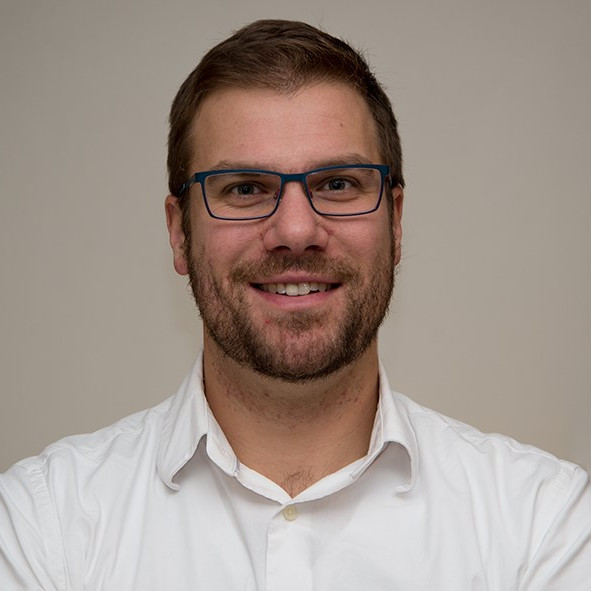
Dr. Michael Branion-Calles
Alumni
Michael is currently a Post Doctoral Researcher in the Department of Medicine at the University of British Columbia. As a part of his PhD, Michael used data collected on BikeMaps.org to investigate the link between active transport, health and safety. Michael is looking forward to leveraging the power of crowd-sourced data in order to better understand cycling safety.
Ben Jestico, MSc.
Alumni
Ben was BikeMaps.org’s first graduate student and was instrumental in the successful outreach in the early days of BikeMaps.org. For his MSc research, Ben compared ridership data collected manually to those using crowdsourced apps such as Strava (http://bit.ly/2af2Cpc). Ben’s research also used data collected on BikeMaps.org to study incidents at multiuse trail and road intersections.
Jeneva Beairsto
Alumni
Jeneva has an M.Sc. in Urban Analytics from the University of Glasgow, and a Bachelor of Arts and Science from Quest University Canada. Her past research has focused on a range of topics related to active transportation: including the optimization of distance-based transit fares and a user-based incentive approach to rebalancing station-based bike-sharing systems. Jeneva is a former Canadian National Wushu (Chinese martials arts) Team member and enjoys spending time doing anything active.
Taylor Denouden, MMath
Alumni, Developer

A graduate of the Geomatics program at the University of Victoria, Taylor is the developer behind the BikeMaps website. Taylor went on to earn a Master of Mathematics in Computer Science at the University of Waterloo. He is now working at the Hakai Institute where he is creating image classification tools for drone and fixed wing imagery along with various other tools for geospatial applications.